This one was a bit special!
With a holiday back to NZ planned to visit my family I’d been on the lookout for an event to do while I was there. We’d be int he NZ for 3 weeks to partially coincide with the kids mid term break from school so dates were limited but while browsing through NZ trail running pages on Facebook I came across what looked to be a winner – the Shotover Moonlight Mountain Marathon, right bang in the middle of our holiday period and offering an awesome looking route running from up the Skippers Canyon through to Moke lake near Queenstown through some beautiful back country scenery through an old gold mining area and around 2600m of climbing – and most of the course was on private land which you’d not normally get the chance to run on. Unfortunately by the time I found it the marathon distance had sold out so I entered the 30km “trail run” option and put myself on the waiting list for the marathon. Just days before Christmas my present came early an a place freed up for the marathon, I was in, I couldn’t wait!
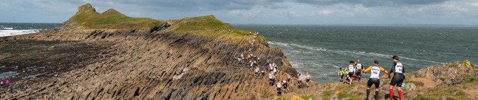
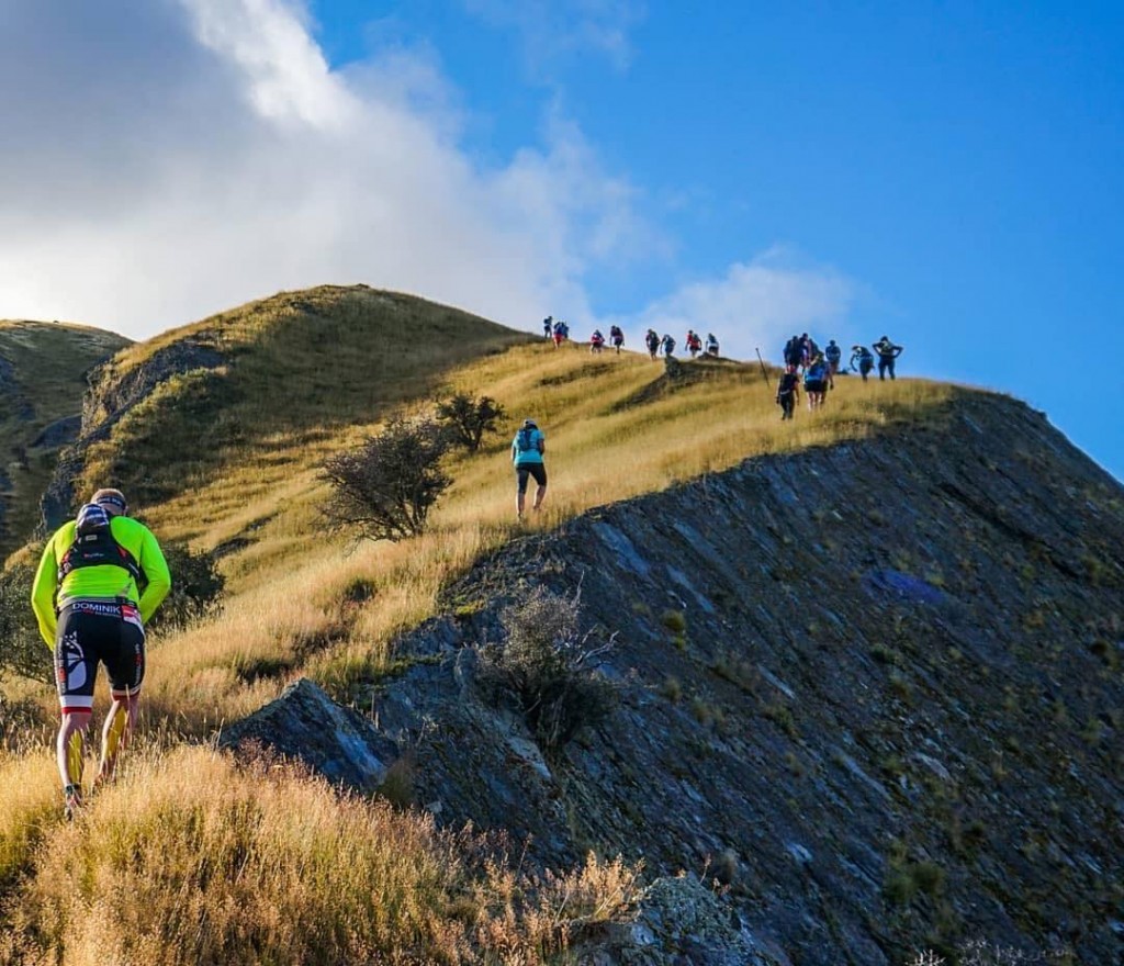
A pretty special location for a marathon
A bit bumpy!
We arrived in NZ about 9 days before the race and immediately I could see I had some acclimatizing to day. NZ was enjoying a lovely period of weather in February with the weather reaching the low 20s most days – a pretty much 20 degree swing from the sub zero temperatures we’d been having in the UK! Then there was the hills/mountains, I’d forgotten that they were bloody everywhere in NZ, and despite my best efforts int he UK (my hilliest training run since Lakes in a day I managed to get 1300m of elevation over 32km by doing endless loops of a short section in the Pegsdon Hills) I found them a struggle. Running from my sisters house in Dunedin I could get over close to 200m elevation gain in the 1.5km run from the bottom to top of her hill!
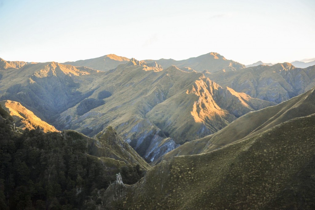
After enjoying a week of camping and chilling out on beaches with my family we all headed over to Central Otago the Thursday before the race, staying at a camping ground in Arrowtown about 20 minutes outside of Queenstown. I’d forgotten just how beautiful the area is, surrounded by beautiful mountains on all sides, it really is an amazing part of the world.
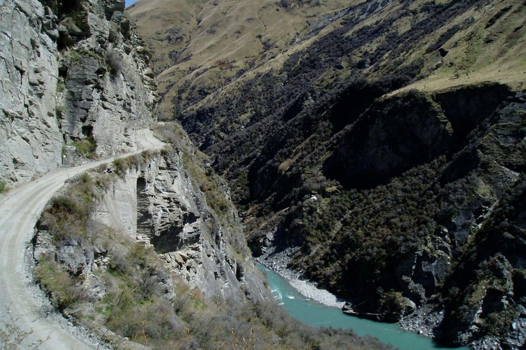
Race day soon came round and I found myself waiting by the side of a street with a bunch of fit looking types just before 6am on Saturday morning. Due tot he remote nature of the course there were only two ways to get tot he start line, helicopter, or by a bus put on by the organisers. I’d opted for the bus. The bus ride tot he start was pretty special in itself, winding it’s way along the Skipper Canyon road (named on a list of the 22 most dangerous roads int he world) it wound it’s way along the side of canyons past the location used for the Gates of Mordor in the Lord of the Rings trilogy to the start at the base for the skippers canyon bungy.
We arrived at the start by about 7am so had almost an hour to take in the scenery and make any last minute toilet stops before making our way down to the start line – which to get to we had to cross a swing bridge across the canyon before making our way down to the river bed below.
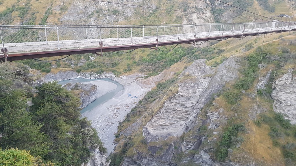
You can just about make out the start down by the river!
At 8am the waiting was over, and we were off, straight back up the hill we’d just come to to get to the start!
Once over the initial climb we wound our way through a bit of a valley before climbing up a ridgeline and following an old gold mining water race around the side of some mountains for the next 8km or so.
I was feeling pretty good and was running well, I actually felt as if I was holding back a bit and was overtaking people of the flatter sections and really enjoying myself. This was probably my favourite part of the whole course, it was all narrow and often rocky single track winding it’s way along the side of the mountain, the sun was up and starting to get warmer and the scenery was just amazing. This instagram video gives you a good idea:
I’d found a good rhythm and was with a small bunch of similar paced runners when I took my first tumble of the day. The track was incredibly narrow with a steep climb on one side and a steep drop on the other and rocks and small turns seemed to come out of nowhere, I took my eye off the ball for a split second as my mind wandered to think about possibly overtaking the person in front and next thing I knew there was no ground beneath my right foot anymore and of was off over the edge of the track. Luckily some tussock broke my fall and I didn’t slide too far down so I was able to scramble back up and join the group soon enough but it did knock my confidence a bit.
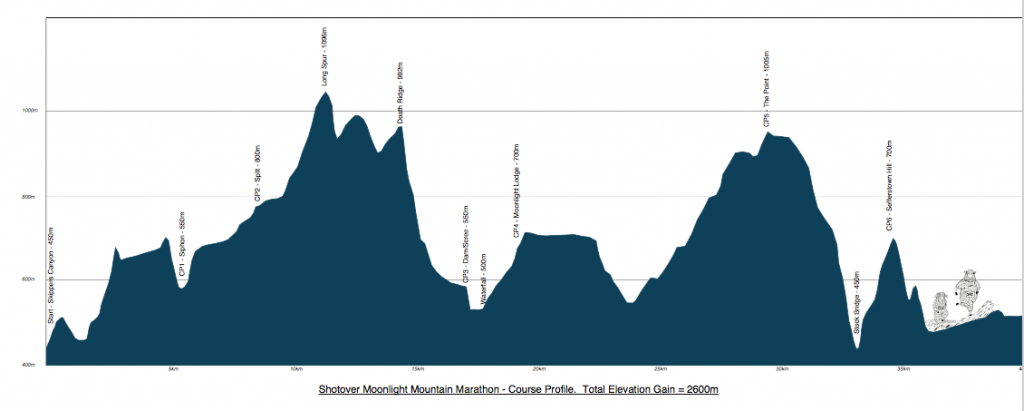
After a while we came off the water race into a small beech forest and after a few stream crossings began to follow Murphys Creek up a valley to the first of the really big climbs of the day up Long Spur.
Sadly my performance started to go downhill with the climb up Long Spur. After an initial reasonably runnable single track for the start of the climb in soon turned into a real slog through often chest high tussock before following the ridge line up to the top and the highest point of the course at just shy of 1100m.
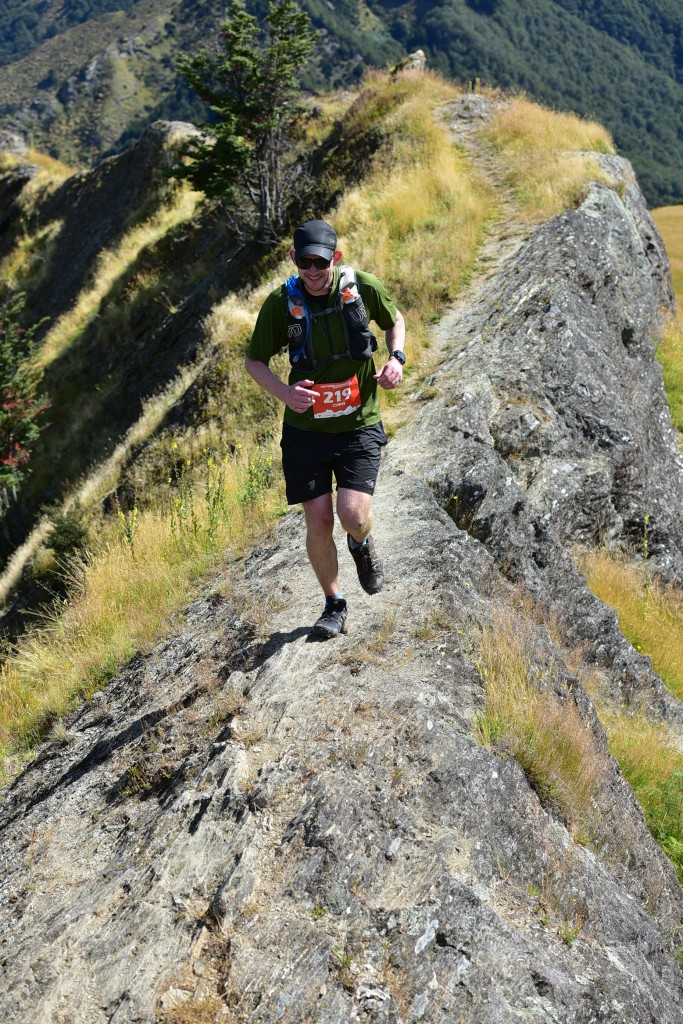
I found it a real struggle and lost quite a few places going up here. No sooner had we reached the top then it was straight back down the other side with a steep descent back through the tussock before climbing up the other side, over a fence and joining a 4wd track for the next few km. This was runnable at least and after a short climb the track descended for maybe a km before we veered off it and back through the tussock for another climb onto “Death Ridge” and the Razorback which despite it’s name wasn’t really scary at all and once on it was a really enjoyable single track run along the ridge line.
It then went into a steep rocky technical descent off the ridgeline into some beech forest, I found this bit really hard on my knees and lost a lot of speed as I made my way carefully down the track before settling into a more comfortable pace once it flattened out again through the forest.
Shortly after this we came to a truly brilliant section of a couple of hundred meters descent down a scree slope. There were a bunch of people in front of me carefully making their way down but I decided to just throw caution to the wind and threw myself straight down it sprinting as fast as I could and just trying desperately to stay upright. I managed to pass a lot of people going down and almost pulled it off before gravity finally got the better of me about 10m from the end forcing me into a spectacular slide to the applause of the other runners around me. Thankfully no damage was done so I was able to quickly dust myself off and carry on.
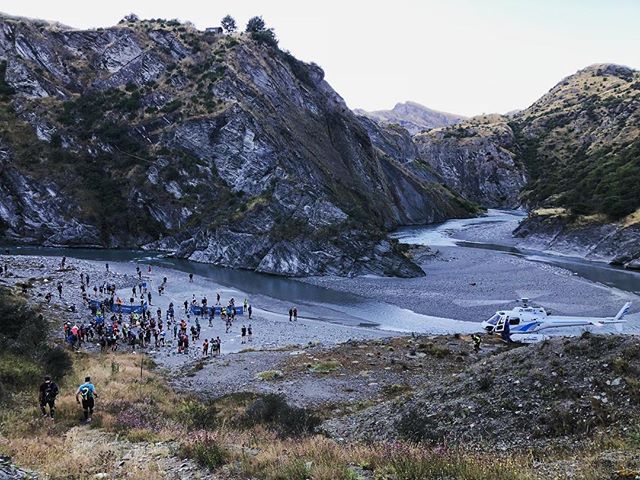
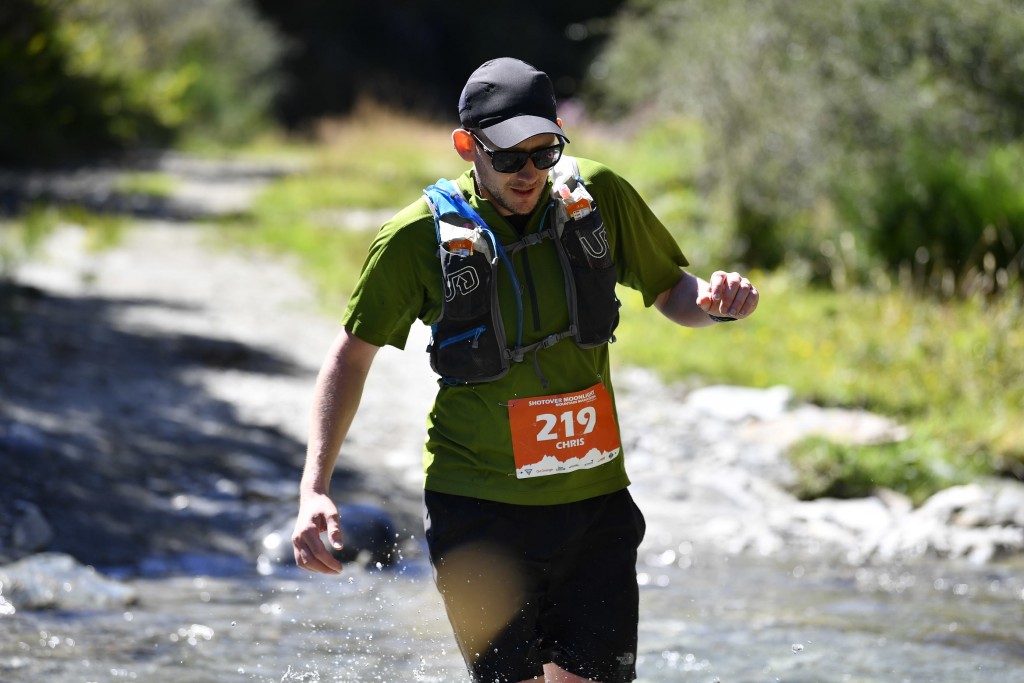
What followed was a couple of hundred meters running along and through a river before being directed up a ladder up a small cliff face and back into native bush forest past some waterfalls, more stream crossings before eventually climbing back out of the forest and another long climb over the next 5km or say the the first major checkpoint and the half way point at Ben Lomond Lodge.
This was the first checkpoint with food so I took the opportunity to scoff a load of watermelon and oranges, refilled my water bottles, made use of the lodges toilets then headed off. The day was really starting to warm up now and must have been getting close to 20 degrees so the fresh fruit really went down a treat.
From the checkpoint we headed up a 4wd track for a bit before veering off up over a rocky ridgeline that required a bit of a scramble to get up before dropping down the other side and rejoining the 4wd track for a nice fast descent for a couple of km before it started to wind it’s way back up the mountain from roughly the 25km mark.
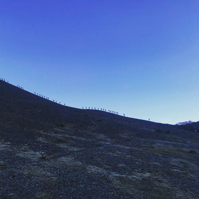
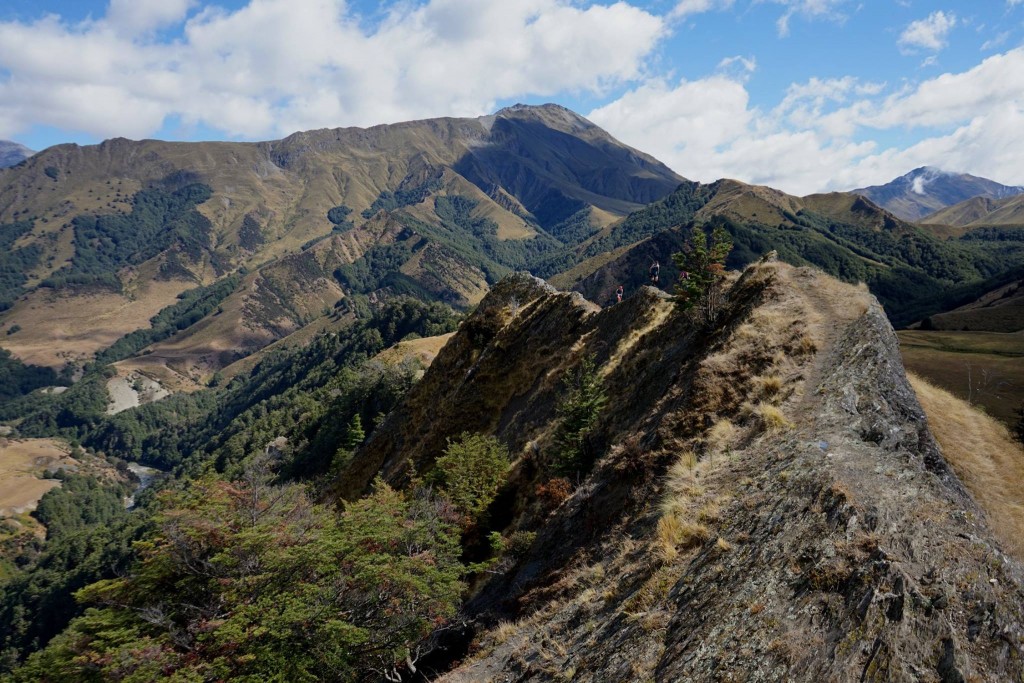
The next probably 8km was the hardest part of the whole course. It was right bang int he middle of the day with NZ’s ozone free sun baring down on me, and the 4wd track wound it’s way up the mountain for about 5km, climbing 500m, with the last km back on the single track as it wound it’s way to the second highest point on the course. Just before the top I passed another small checkpoint where the marshal manning it pointed out that if I looked across the valley I could see the final checkpoint at the top of the last climb, it was sitting just at the top of the track in the image below. 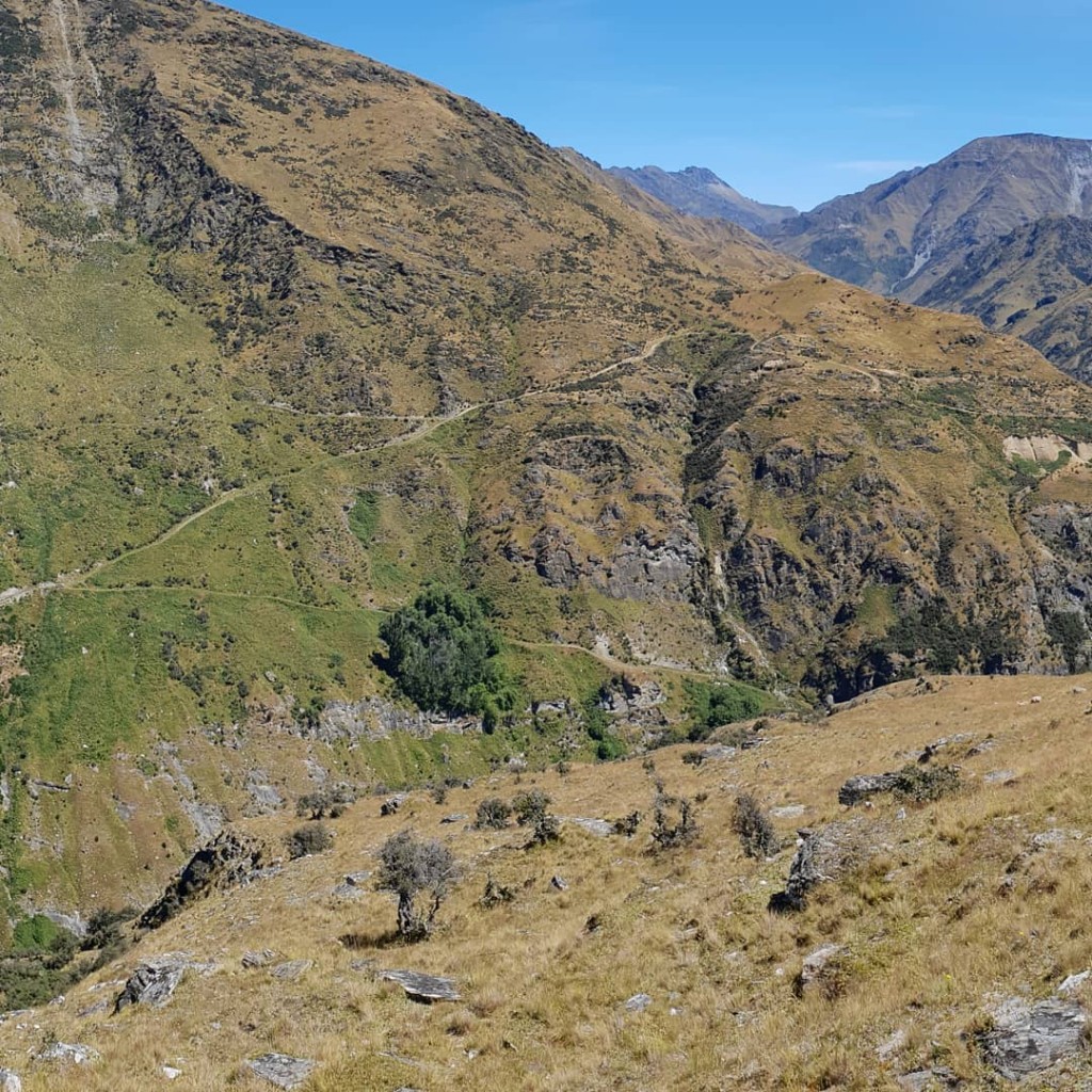 He also said I’d hate getting there! It required a very steep descent, loosing about 600m of elevation in 3km (with no track to follow at all) straight down from where I was to the bottom of the valley before following the 4wd track back up the otherside, regaining 300m of elevation in little of 1km.
The descent was pure agony, after all the climbing and descending my poor legs were shattered and didn’t know what to do, my calves were constantly cramping and at one point both cramped at the exact same time leaving me with no choice but to through them out in front of me and skid down the slope on my bum for a bit. Early on in the descent a girl passed me and made a joke about all the animal bones scattered around the side of the mountain being the remains of last years competitors, I was beginning to wonder if I’d be adding the pile. after what seemed like an age (the 3km of descent took me almost 45minutes!!!!) I reached the bottom, crossed the bridge over the stream at the bottom and started to slowly make my way back up the 4wd track for the final (big) climb of the day.
I was joined for the climb by another Chris, a Queenstown local who’d only signed up for the race a couple of weeks beforehand having taken a friends place. Chatting to her as we made our way up the climb helped take my mind of the task at hand a bit and was a nice change after over 6 hours of running largely on my own. 1km and 25 minutes later we’d reached the aid station! More delicious watermelon awaited and after feeding up and refillign my water bottles once again (I drank about 4.5litres over the course of the race!) I headed up over the top of the saddle and started the descent down the other side.
After the slog of the last 8km of I was desperate to run again and once over the saddle we rejoined a 4wd track for a nice descent for the next 2km and the 37km mark back down to the river bed. The final 5-6km was a very gradual uphill (although it seemed flat after what we’d been through) to the finish with over a dozen river crossings and trip trough an old miners tunnel as we wound our way to the finish. I’d been rejoined by Chris at about 38km and we kept each other going for the next few km encouraging each other to keep jogging and chatting away to try and get the time to pass quicker.
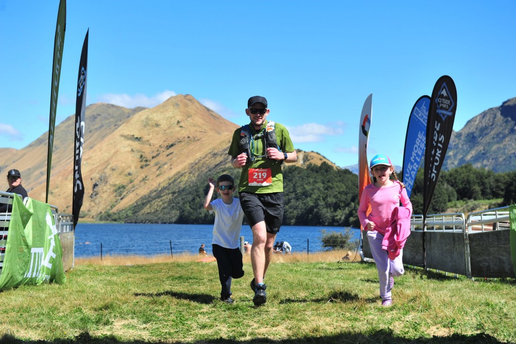
With about a mile I was getting a bit of a second wind as I could hear the finish line int he distance so after some encouragement from Chris managed to speed up a bit for the final stretch. About 300m from the finish I passed my Mum, Dad , Sister, Emma and the kids waiting by a river crossing, as I passed with Erin and Ben ran off with me to guide me to the finish line. 7 hours and 40 minutes after starting I finally crossed the finish line accompanied by Erin and Ben, collected my medal and free beer and collapsed in a heap.
Beer has never tasted so good!
What a day, the course/terrain was probably the toughest I’d done with so many technical sections that I had actually felt a bit out of my depth at times, but it had been absolutely brilliant. The course had everything, tough climbs, punishing descents, brilliant singletrack, forests, exposed mountain sides, ridge lines, scree, waterfalls, probably close to 30 river crossings, tunnels, ladders not to mention the constantly amazing scenery. I absolutely loved it and would do it again in a heartbeat.
You can ‘relive’ the route on the link below or the promo video also give a good taste of the sort of day I had (minus the shattered legs!)